17. Карты Тартарии
Tartary 1814 World Atlas
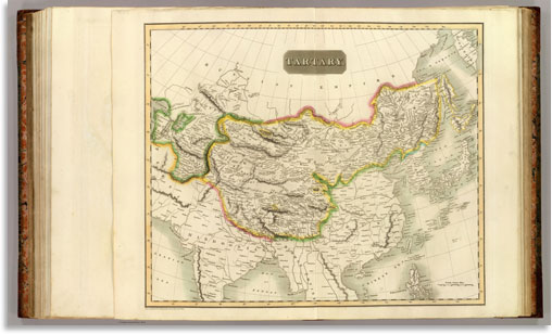
Tartary. N.R. Hewitt sc., 10 Broad Str., Bloomsbry., London. Drawn and engraved for Thomson's New general atlas, Sepr. 1st., 1814.
Скачать большое изображение 11361 x 6824 px_ 13.1Mb
Central Asia India 1895 World Atlas
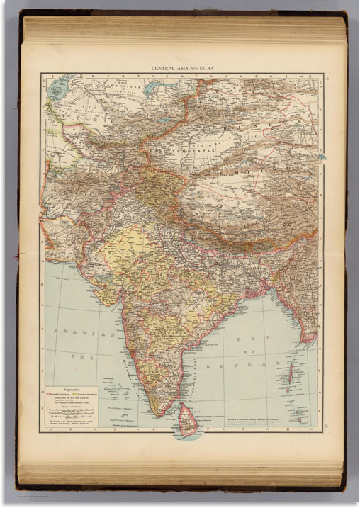
Central Asia and India. (Published at the office of "The Times," London, 1895)
Скачать большое изображение 6496 x 9208 px_12.4 Mb
Centralasien Ostindien 1881 World Atlas
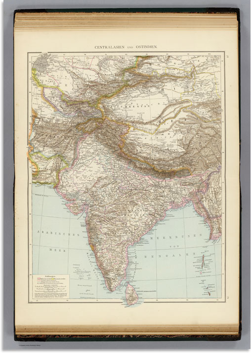
Centralasien und Ostindien. (Richard Andree. Herausgegeben von der Geographischen Anstalt von Velhagen & Klasing in Leipzig. 1881)
Скачать большое изображение 6440 x 9112 px_12.7 Mb
Indoscythicum atque Parthicu 1865 Classical Atlas
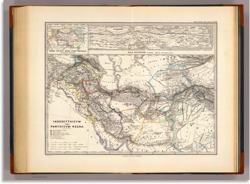
Indoscythicum atque Parthicum Regna. (with) Imperii Parthici Regna atque provinciae ad mentem Ptolemaei. (with) Asia Superior secundum tabulam Peutingerianam. F.v. Stulpnagel del. Gothae: Justhus Perthes. Spruner-Menke atlas antiquus. (1865)
Скачать большое изображение 9148 x 6696 px_9.7 Mb
Russian Empire west 1799 World Atlas
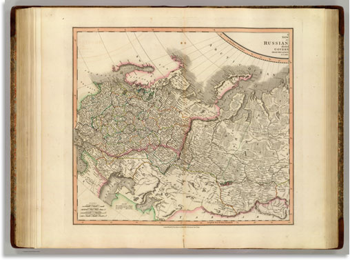
A new (map) of (the) Russian (Empire,) divided (into its) govern(ments;) from the latest (authorities, by) J. Cary, (engraver) (west sheet) London: Printed for J. Cary, Engraver & Map-seller, No. 181, Strand, Aug. 1st., 1799.
Скачать большое изображение 11353 x 8369 px_17.9 Mb
Tartary Chinese independe 1806 World Atlas
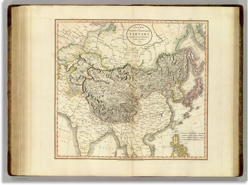
A new map of Chinese & independent Tartary, from the latest authorities. By John Cary, engraver, 1806. London: Printed for J. Cary, Engraver & Map-seller, No. 181, Strand, Decr. 1st, 1806.