17. Карты Тартарии
Partie lEmpire Chinois As 1827 World Atlas
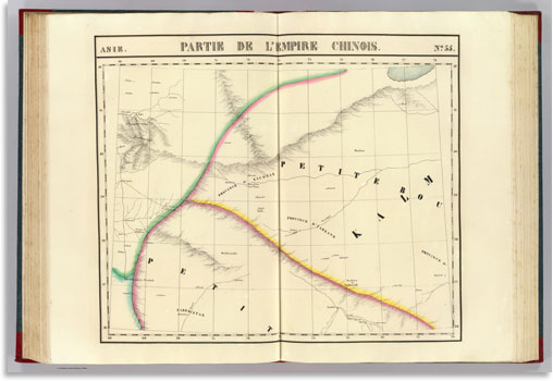
Partie de l'Empire Chinois. Asie no. 55. (Dresse par Ph. Vandermaelen, lithographie par H. Ode. Deuxieme partie. - Asie. Bruxelles. 1827)
Скачать большое изображение 10100 x 6906 px_9.7 Mb
Central Asia 1804 World Atlas

Central Asia. From Du Halde, D'Anville, Jelenieff &c &c., but imperfect and inaccurate authorities. Hooker sc. (Published by John Conrad & Co., Philadelphia. 1804)
Скачать большое изображение 7543 x 4668 px_6.9 Mb
Tartarie Independante 1791 World Atlas
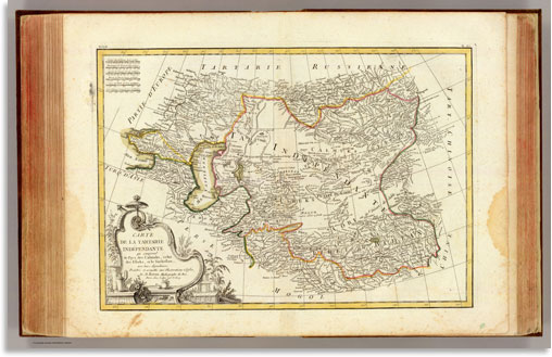
Carte de la Tartarie Independante qui comprend le Pays des Calmuks, celui des Usbeks, et le Turkestan, avec leurs dependances, projettee et assujettie aux observations celestes, par M. Bonne, Hydrographe du Roi. A Paris, chez Lattre, rue S. Jacq. Arrivet inv. & sculp. (1791)
Скачать большое изображение 7840 x 5036 px_7.7 Mb
Oriens 1835 World Atlas

Oriens. Fenner Sc., Paternoster Row. (London, Joseph Thomas, 1835)
Скачать большое изображение 3012 x 2683 px_1.3 Mb
Persia adjacent countries 1747 Geography Book
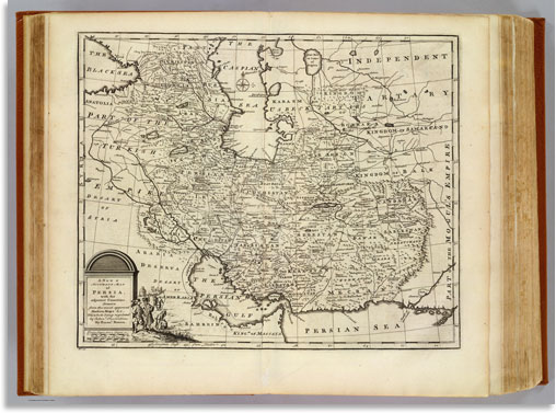
A new & accurate map of Persia, with the adjacent countries. Drawn from the most approved modern maps &c, the whole being regulated by astronl. observations. By Emanl. Bowen. (London: Printed for William Innys, Richard Ware, Aaron Ward, J. and P. Knapton, John Clarke, T. Longman and T. Shewell, Thomas Osborne, Henry Whitridge... M.DCC.XLVII)
Скачать большое изображение 11578 x 8545 px_20.2 Mb
Tartary 1823 World Atlas
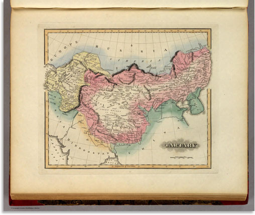
A General Atlas Containing Distinct Maps Of all the Known Countries in the World, Constructed from the Latest Authority. Written and Engraved by Jos. Perkins, Philadelphia. Baltimore: Published by Fielding Lucas, Jun. No. 138, Market Street. Baltimore. Entered... by F. Lucas Jr. of the State of Maryland June 3, 1823.
Скачать большое изображение 4975 x 4199 px_3.4 Mb
Central Asia 1844 World Atlas
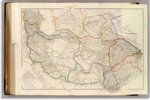
Central Asia; comprising Bokhara, Cabool, Persia, The River Indus, & Countries Eastward Of It... By his obliged Servant, J. Arrowsmith. June 1834. (Map) 29. London, Pubd. 15 Feby. 1842, by J. Arrowsmith, 10 Soho Square.