17. Карты Тартарии
Central Asia 1834 World Atlas
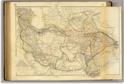
Central Asia; comprising Bokhara, Cabool, Persia, the River Indus, & countries eastward of it. Constructed from numerous authentic documents, but principally from the original M.S. surveys of Lieut. Alex. Burnes, F.R.S. to whom this map is most respectfully dedicated, by his obliged servant, J. Arrowsmith. June 1834. London, pubd. 16 June by J. Arrowsmith, 35 Essex Street, Strand.
Скачать большое изображение 10294 x 6924 px_12 Mb
Independent Tartary 1851 World Atlas
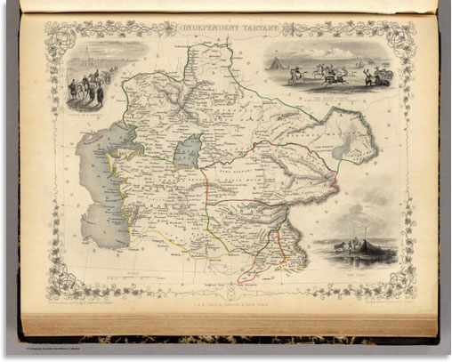
Independent Tartary. The Illustrations by W. Bragg & Engraved by J. Rogers. The Map Drawn & Engraved by J. Rapkin.
Скачать большое изображение 4700 x 3750 px_3.6 Mb
Russia In Asia and Tartary 1846 World Atlas
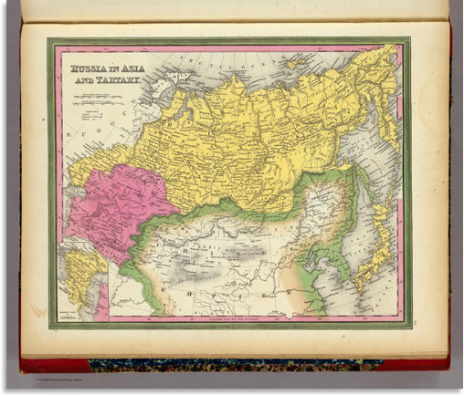
Russia In Asia And Tartary. (with) Western Part Of Russia.
Скачать большое изображение 5658 x 4819 px_6.1 Mb
W Siberia Tartary Khiva 1838 World Atlas

Western Siberia, Independent Tartary, Khiva, Bokhara &c. J. & C. Walker sculpt. Published by the Society for the Diffusion of Useful Knowledge, 59 Lincolns Inn Fields, Novr. 20th. 1838. (London: Chapman & Hall, 1844)
Скачать большое изображение 6154 x 7150 px_9.2 Mb
Bokhara Cabool Beloochista 1838 World Atlas
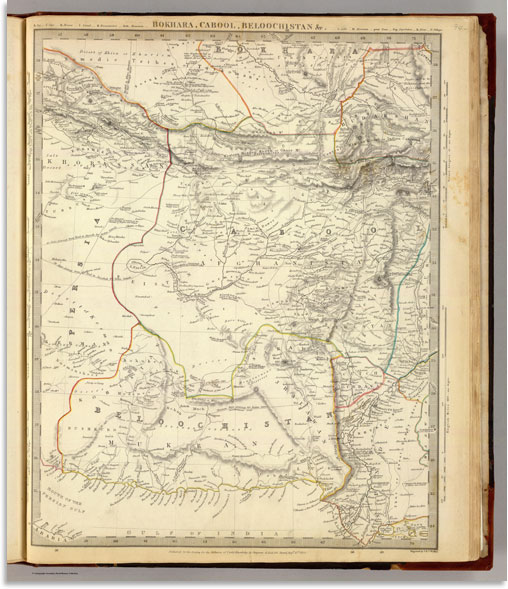
Bokhara, Cabool, Beloochistan &c. Engraved by J. & C. Walker. Published for the Society for the Diffusion of Useful Knowledge by Chapman & Hall, 186 Strand, Augst. 15th. 1838 (1844)
Скачать большое изображение 6154 x 7150 px_9.5 Mb
Russia In Asia and Tartary 1836 World Atlas
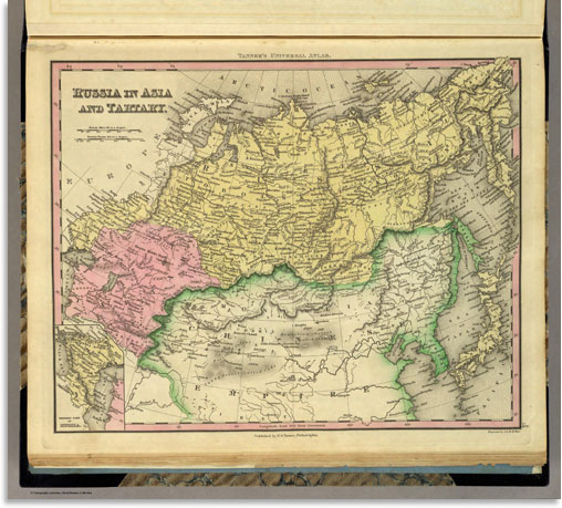
Russia In Asia and Tartary. (with) Western Part Of Russia. Engraved by J. & W.W. Warr. Published by H.S. Tanner, Philadelphia. (above neat line) Tanner's Universal Atlas.